Gutharraguga
Gutharraguga - Shark Bay
Gutharraguga, meaning two bays in the language of the indigenous Malgana Peoples, or Shark Bay, as it was renamed by English explorer William Dampier in 1699, is a bit more than half way up the west coast of Australia. The area is World Heritage listed for its beauty, abundance, prehistoric life forms, evolution in action and wildlife refuges. We didn’t know all this before we chose to visit, it just looked on the map like an interesting bit of coastline that I would dearly like to talk to my late Geography teacher, Mr Green, about. Plus, it includes Steep Point, the most Westerly point on the Australian mainland, and once we found that out, we decided to try to do all four points starting here.
We stayed at Hamelin Outback Station, previously a working sheep and goat farm and now owned by Bush Heritage Australia, which is re-wilding the station to encourage native flora and fauna to return. Since the late 1990s, this not-for-profit organisation has acquired over 22 million acres of farm land across Australia. The land has been de-stocked and is now being actively managed in partnership with Aboriginal peoples to remove feral cats and dogs that have decimated native species. Native plants have slowly reestablished, mostly naturally, and native creatures are being carefully bred, reintroduced and assisted to flourish, mainly by control of feral cats and dogs. A tiny proportion of this land is open to visitors and even less to campers so we felt privileged to have accidentally found this beautiful spot.
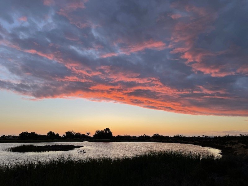
The camp ground was covered with tiny white shells, used just like gravel, it provided a bright foil for the surrounding plants and you definitely need your sunnies on for the first trip to the dunny in the morning! Old sheering sheds were set up as a museum to give an overview of the station’s former life; it must have been hard for the shearers but worse for the sheep. A man-made lake and reed bed, that was only a few years old, sat remarkably well into the landscape and was home to many wetland birds.
Hamelin Outback Station lake
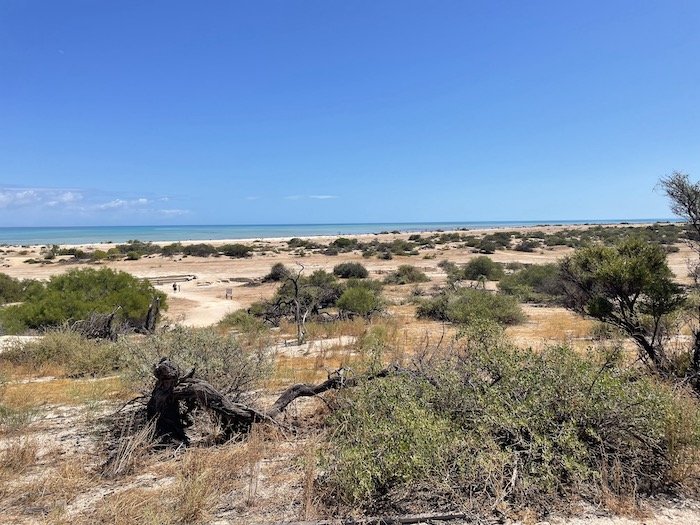
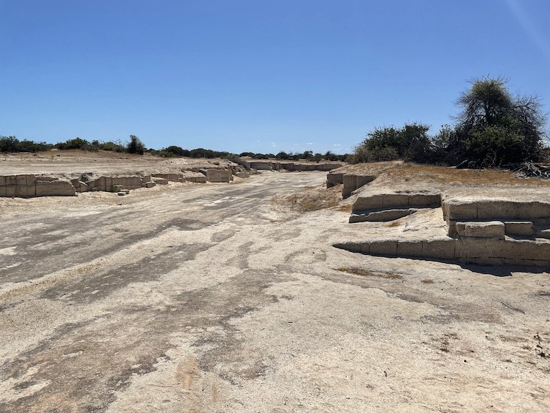
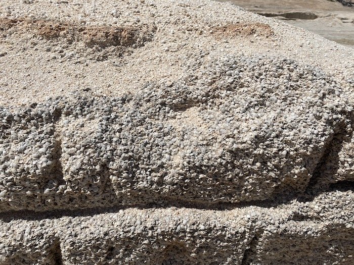
From the camp ground we walked the 6km along a bush track to the coast line. The red dust pathway wound amongst the beautifully scented shrubs. These provided no shade so we were thankful for the two litres of water we had in our bladder back packs, but regretted setting off mid morning. We visited the small open mine where early white settlers cut blocks of coquina, ancient compressed tiny shells which extend to 10m below ground, to use as building blocks. Even in the winter, the sun was scorching and the blinding white coquina seemed to make it brighter. It must have been a hard life for those folk using giant bow saws to cut out blocks the size of about six bricks.
Coquina quarry
Coquina blocks
Tiny compressed shells
Along the beach a further kilometre, is one of only two areas in the world where stromatolites can be found, the other is in the Bahamas. These ancient living structures protrude from the sand like small domed posts, about the diameter of a dinner plate, that can currently only be seen at low tide. A boardwalk constructed to carefully pick its way through the stromatolites, providing a better view when the tide is in, had been badly damaged by a cyclone that hit the coast last year.
Volunteer guides, Peter and Jenny, took pity on us daft Poms out in the mid-day sun and kindly drove us back to our campground. I think we would have been ok to walk but felt humbled by the gentle manner in which Peter shared a little of his experiences of working as an outback police officer and rescuing wayward travellers who underestimated how unforgiving this environment can be.
After a couple of nights we headed up the Easterly peninsular and had a one night stop at Nanga Bay Resort Caravan Park, a perfectly positioned, once grand but now very run down, camp ground. It did however provide a sheltered spot on a really windy wet day from where we did a recce of some of the wild coastal free camps. They all looked good but we decided to go further North, beyond the small town of Denham, to Wulyibidi, more commonly known as Peron peninsular. This area, now a National Park, is named after François Péron, a French explorer and naturalist who documented the region in 1801. Once a sheep and cattle station, the native flora and was pretty much eaten to extinction by stock, rabbits and introduced predators. Under Project Eden the habitats are being restored and native creatures are being successfully reintroduced .
The tracks in this NP are deeply corrugated so we aired down at the entry gate. We put our camp fees of $11 per person per night for four nights in the honesty box. You can’t book in advance but there are always sites, although they may not be your first choice. Peter and Jenny from the stromatolites had been camp volunteers at the Big Lagoon camp ground and advised that, even if the sign says it’s full, drive up and chat with the volunteers as they will know who’s leaving when. Our timing was good because, as we were driving down the 12km red dirt track to Big Lagoon, we passed three other rigs going the other way and we got a cracking spot with a view over the crystal clear blue water.
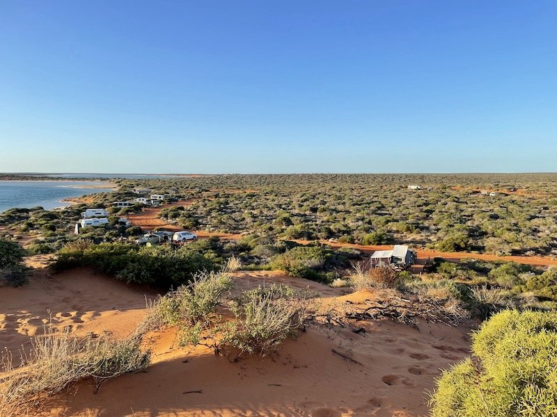
Big Lagoon camp site, Francois Peron National Park, WA. We are second van in from the far end facing the sea
We stayed four nights and made friends with three young couples travelling together, Clanger and his brother Darcy with respective partners Lauren and Libby, who were on a round Australia trip in their Troopys. Their friends Kate and Damo had flown over from Tasmania for just a few weeks of the trip. Meeting delightful folk like this is such a lovely part of travelling, we hoped to meet up again near Steep Point or maybe south of Perth in a few weeks time.
Outback traffic jam
Beyond Big Lagoon, the rest of the park is only accessible to high clearance 4WD vehicles with tyres aired down to 15psi or less because there are sections of deep, soft sand but more than the odd numpty seems to think this guidance doesn’t apply to them. We met a few when we took a 100km day trip to the top of the peninsular. Still feeling pretty inexperienced ourselves, we found ourself helping a group of five vehicles who had all got bogged in the sand. Not only were they stuck with road tyre pressures, no means of re-inflation and no recovery gear but were also very sunburned so clearly safety advice doesn’t apply to them either! We learnt it pays to be prepared and listen to the many travellers happy to advise.
Several bays on the Northwestern coast have campgrounds and day visitor parking along with free electric or gas BBQs, picnic shelters and long drop loos. They have lovely sandy beaches, perfect for sand castles and safe swimming so are great for families; it was fun watching the little ones in their long-sleeved bathers and big brimmed hats having a wail of a time. These spots are also really popular with fishers using little metal boats, known as tinnies, or casting straight off the beach. The rules on where people can fish, what, when and how much they can catch with what equipment are really strict and rigorously policed to protect certain species, breeding times and the wider marine environment. People generally eat what they catch and being close to the source of their food can bring a different level of appreciation for the life they are taking but, as they are unlikely to starve here without the fish, it still feels like killing living beings for sport to me.
Skipjack Point, Francois Peron National Park
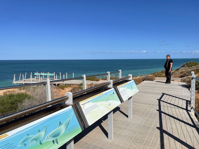
At the top is the spectacular Cape Peron Look Out, a steep red cliff with Indian Ocean views. Then, a little further round, to the East is Skipjack Point which has a metal boardwalk and viewing platform providing a fantastic view of sea creatures in shallow water against the white sea bed. We saw a small black shark, a Manta ray and a Dugong, pointed out to us by some young children more used to spotting such creatures.
After hearing mixed reviews about the well publicised Monkey Mia resort on the more sheltered East coast, we decided to check it out and decide for ourselves. They make much of the conservation aspects of the resort and ‘marine research’ that takes place there but this appeared to be very minor undertaking alongside a tremendous money making tourist trap. The very informative exhibition about the re-wilding project, native land creatures and marine life could be a brilliant interactive space but instead is tucked away in a tatty corner to allow space for a gigantic tat shop selling stuff mostly made of plastic that is soon destined for land fill. The promise of feeding dolphins, which is actually undertaken very carefully, attracts over 200 guests each morning all elbowing to get the best view brings out the worst in some adults and children alike. It was the most expensive and least attractive place we have stayed so far. That said, if guests leave with a better appreciation of the marine world, then perhaps it helps.
Our next stop was Edel Land National Park on the Westerly peninsular of Shark Bay, where we had secured two nights at Turtle 2, one of the few sites on Shelter Bay on the Eastern coast, not far from Steep Point. This peninsular also used to be a sheep station and, up to the 1990s, had been stripped of native flora and fauna and is now being re-wilded. It is windswept and largely uninhabited with the exception of a remote salt mine on the East coast where workers live at the fabulously named Useless Loop, about six hours drive from the nearest town. The campgrounds are 1-2 hours further on.
All the roads are heavily corrugated with long rocky sections and in pretty poor condition. Beyond Useless Loop, the advice is to reduce tyre pressures to around 15psi as there are steep very sandy tracks and areas where the shifting dunes encroach onto the tracks in a matter of just a few days. Despite following all this advice, we got bogged a couple of times and made good use of our Max Trax and aired down further to 12psi. Ian wanted footage of this and asked me to ‘be like a war correspondent’ and film the action rather than helping the situation. It was uncomfortable filming him digging our wheels out that were bogged to the axles in hot soft sand, then doing it all over again 3m further up the hill but you can watch the extraction here. Max Trax have recently added orange straps to help locate them after a rescue, good job too, they were completely buried and I’m sure people have lost them on this stretch before. At the top of the hill the dunes resembled the Sahara Desert and at that point we were unsure how much more sand us novices could manage. Thankfully, only the pointy end of one dune was in the way and didn’t hold us up for long.
We checked in at the rangers station just before getting to our site on Shelter Bay just after sunset so we made a swift set up and shut ourselves in for the night looking forward to catching up the next day with Clanger, Lauren, Darcy and Libby who arrived the previous day. After a windy night we awoke early to a stunning view across the bay but no sign of the guys. We knew they were crossing to Dirk Hartogg Island from just up the beach, so kept an eye out. Just after 7am they arrived having camped at The Oven near Steep Point to stay out of the wind. We waved them one at a time onto the little barge that drops its ramps onto the beach to allow single vehicles on for the 15 minute trip to the Southern tip of Dirk Hartog Island.
Shelter Bay approach
Our rig on Shelter Bay
Rocky tracks extend in a few large loops around the peninsular so we packed a picnic and set off to explore. We started at The Oven, a sheltered cove at the top of the cliff that had puzzling metal rings all along its walls which we later discovered are for fishers to anchor themselves to avoid being pulled over the cliff as they wrestle their giant catch or caught by a gust of wind. Crazy though it seems, this pastime is very popular and is a main reason for the majority of trippers to the area. We arrived just having missed a mother whale and its calf which swam off, repeatedly breaching, round the coast towards Steep Point.
When we arrived at this most Westerly point, the whales had gone so we took the customary photo and checked out the interesting rocks with hardy plants clinging in every nook and cranny. Had it not been so sunny, it could have seemed bleak but, even though it was no doubt so at times, the vastness of both the ocean and this lonely, harsh landscape once again took my breath away. The central spot, known as Dicko’s Lookout, provided a panoramic view and this film gives the barest hint of what it’s actually like.
The West coast of the peninsular is predominantly cliffs, some rising 170m above sea level. The challenging rocky track goes quite close to the edge at times and is hard to see in part so after a while of me saying ‘wow, look at that coastline’ I was asked to stop providing a distractions that Ian couldn’t safely follow and we paused to look at the views. The dramatic cliffs are made more so by the white-crested waves constantly crashing against them; some are even driven up narrow openings in the rock which funnel the water up and out of blow holes 20m into the air.
Cliff fishing - zoom in
Steep Point, the most Westerly point in Australia
Thunder Bay, Edel Land National Park, WA
After our day out, we were wishing we had booked to go to Dirk Hartog too so, the following day, we checked we could stay at Shelter Bay another couple of nights then Ian climbed up a sand dune to get enough signal to call the ferry booking line. Our rig was oversize but we knew if we removed the extended draw bar on the tow hitch we would be exactly the maximum length. this crucial measurement checked the ferry was booked for the next crossing in two days time, we waited for the wind to drop before getting started. The forecast was for even more wind the following day so we cracked on mid afternoon knowing it could be worse the next day. To ensure the shortened hitch didn't cause the Troopy and Kimberley to collide on tight turns or slopes, we removed the spare wheel from the back of the Troopy , to get it inside, we had to operate the drop slide on the fridge to get it in sideways.
The 80 litre top loading Engel fridge/freezer in the Troopy which, combined with the small fridge in the Kimberly, allows us to carry enough food for 3-4 weeks. It is too tall to open fully inside because we have storage drawers underneath so it is mounted on a drop slide, a gadget that slides it out the back doors then lowers it to a manageable height to open. It is really convenient to keep our lunch and water cool if we go out for the day and we tend to decant stores from it into the more convenient Kimberly fridge every few days. It runs entirely on solar or space engine electrical power.
All sounds great, but at this critical point of trying to get a wheel over it in what felt like a raging sandstorm, a bearing on the drop slide that had, unknown to us, shattered earlier caused the fridge to stuck half way out the door. By this time, it was dark as well as windy so we were working by torch light wishing we had left it to the following day. After much clambering about in a cramped space, and utilisation of every tool in the box, a temporary fix was made that got it working. We were ready for our crossing and holed up in the Kimberley awaiting our slot at 7am the following day.
Dirk Hartog Island barge
We were very excited, whist somewhat anxious, as we waited on the beach for our turn. I was wondering about how we might retrieve or belongings from the bottom of the ocean if we capsized and had hatched an elaborate plan during the 40 minute wait. The first two vehicles had crossed without a hitch but when it came to our go, we started our engine, rolled down the beach only to see the ferry man waving to stop us. As he said he wouldn’t take us, I could hear Chris de Burgh lyrics playing in my head because we’d already paid him!
Although we were within the maximum length, he felt the size and weight of our rig was too risky. He’d done one like ours but with a slightly smaller car before and, in his words, ‘it hadn’t gone well’ and he wouldn’t do it again. To be honest, we were both disappointed and at the same time just a little relieved. It turned out Ian too had been looking at this little barge and worrying about its ability to stay pointy side down in such strong winds. We vowed to return another time when we were set up to camp without a caravan and set a course to leave the Shark Bay area; we had a few hours drive to decide whether to go further North or start our journey towards Melbourne.
Having already experienced the tricky tracks on the way in, we were well prepared but the encroaching dune had got much bigger after four days of constant wind and consumed the wheels again. We’re getting better at un-bogging ourselves each time we do it but I’m not really sure that’s a good measure of success. The drive off the peninsular was made easier thanks to the dirt road being graded. This process involves a machine scraping off the corrugated surface then, it is wetted by a big tanker, finally a rubber wheeled roller gets the dirt to stick together hopefully flatter than when they started. They were still at it when we passed through so we got the full before-and-after experience and it was definitely flatter.

